*Note, reroute issue effects the 100 mile race only.

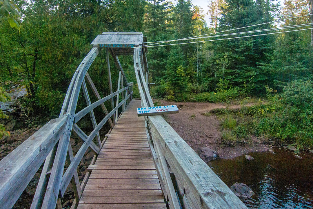
The good old Split Rock River bridge between the race start at Gooseberry Falls State Park and the Split Rock Aid Station had seen better days and has since been dismantled and is awaiting replacement.  As a result of this bridge outage we have identified two potential Superior 100 Mile Trail Race course reroute scenarios for this years race, as follows.

1.) If there has not been much rain the week of the race and there is not a likely rain event in the forecast overnight, then we will will fjord the river near the old bridge site.  Depending on recent precipitation and associated river levels the crossing spots identified will likely be between shin and knee deep with only moderate current.  Due to the location of the best crossing spot, that allows runners easy access and will not incur river bank erosion – the distance for the Gooseberry to Split Rock section will be reduced by approximately .4 miles.

2.) If the water is high from rain events the week of the race and / or there is the potential for significant rain overnight (before the start of the race) we will cut out the Split Rock River Loop entirely, making up the lost distance on the paved Gitchi Gami bike path that the race already starts out on and leaving the distance to the first aid station (Split Rock) relatively unchanged from 2016.  While it is tempting to make up the lost distance with single-track trail, there is not an opportunity to do so in the first section of the race and pushing this to another / later section would have a cascading effect on aid station open times, aid station closing times, cutoffs, volunteer shift times and general race logistics.

Regardless of the route choice, it will be well marked, there will be additional course markings and additional volunteers / course marshalls to facilitate the changes.  The race will remain in excess of 100 miles and the overall segment distance to the first aid station will remain relatively unchanged.  As always our number one priority is runner safety, closely followed by runner experience and we feel that this will plan will allow us to achieve both goals.  Regardless of the route, it happens so early in the race that it will be a distant memory as you cross the finish line on Saturday.

Notification of what route will be used will be delivered during the 100 mile pre-race meeting in Two Harbors on Thursday night after the race director and trail marking team assess the river crossing and mark the determined route on Thursday.

Superior Fall Trail Race
100MI, 50MI, 26.2MI Trail Race(s)
Lutsen, Minnesota
(approx 4hrs North of Minneapolis, MN)
September 11 & 12, 2020
100MI Friday 8:00AM
50MI Saturday 5:15AM
26.2MI Saturday 8:00AM

Registration / Lottery:
Registration via 15 day lottery registration period.
Opens Wednesday January 1st, 2020 – 12:01AM CST
Closes Wednesday January 15th, 2020 – 11:59PM CST
Complete Lottery / Registration Details HERE

Directions:
100MI Start: Gooseberry Falls State Park, MN HERE
50MI Start: Finland Rec Center – Finland, MN HERE
26.2MI Start: Cramer Road – Schroder, MN HERE
Races Finish: Carbibou Highlands – Lutsen, MN HERE

Terrain:
The Superior Fall Trail Races 100MI, 50MI & 26.2MI are run on rugged, rooty, rocky, 95% single-track trail with near constant climbs and descents.  The race is held on the Superior Hiking Trail in the Sawtooth Mountains paralleling Lake Superior in Northern Minnesota / not far from the Canadian border.  The race located approximately 4 hours North of Minneapolis, Minnesota.   The Superior Fall Trail Races are very difficult / challenging races and are probably not a good choice for your first trail or ultra race (see Registration Info for qualifying requirements).

100 Mile:
Point to Point 103.3 Miles
Elevation Gain 21,000 FT
Elevation Loss 21,000 FT
NET Elevation Change 42,000 FT
13 Aid Stations
38 hour time limit
Complete 100MI Info HERE

50 Mile:
Point to Point 52.1 Miles
Elevation Gain 12,500 FT
Elevation Loss 12,500 FT
NET Elevation Change 25,000 FT
7 Aid Stations
16.75 hour time limit
Complete 50MI Info HERE

26.2 Mile:
Point to point 26.2 Miles
Elevation Gain 5,500 FT
Elevation Loss 5,500 FT
NET Elevation Change 11,000 FT
3 Aid Stations
14 hour cutoff
Complete 26.2MI Info HERE

More About the Race:
The Superior Trail 100 was founded in 1991 when there was no more than a dozen or so 100 mile trail races in the USA, back then if you wanted to run a 100, you had choices like Western States, Hardrock, Leadville, Wasatch, Cascade Crest, Umstead, Massanutten and Superior . Superior quickly earned it’s reputation of its namesake today – Rugged, Relentless and Remote and is known as one of the tougher 100 mile trail races.  Superior lives on now as one of the “legacy 100 milers” and is considered by many to be one of the most challenging, prestigious and beautiful 100 mile trail races in the country. Shortly after the inception of the 100, the Superior 50 was started and in the early 2000’s the Moose Mountain Marathon was added. None of the history or tradition of this race has been lost and is a great event for those looking for a world-class event with a low-key, old-school 100 miler feel.  The Superior Trail Race is put on by ultrarunners for ultrarunners.

More About the Area:
The North Shore of Lake Superior runs from Duluth, Minnesota at the Southwestern end of the lake, to Thunder Bay and Nipigon, Ontario, Canada, in the North to Sault Ste. Marie, Ontario, in the east. The shore is characterized by alternating rocky cliffs and cobblestone beaches, with rolling hills and ridges covered in boreal forest inland from the lake, through which scenic rivers and waterfalls descend as they flow to Lake Superior. The shoreline between the city of Duluth to the international border at Grand Portage as the North Shore.  Lake Superior is considered the largest freshwater lake in the world by surface area. It is the world’s third-largest freshwater lake by volume and the largest by volume in North America.  The Superior Hiking Trail, also known as the SHT, is a 310-mile long distance hiking single-track hiking trail in Northeastern Minnesota that follows the ridgeline overlooking Lake Superior for most of its length. The trail travels through forests of birch, aspen, pine, fir, and cedar. Hikers and runners enjoy views of boreal forests, the Sawtooth Mountains, babbling brooks, rushing waterfalls, and abundant wildlife. The lowest point on the trail is 602 feet above sea level and the highest point is 1,829 feet above sea level.