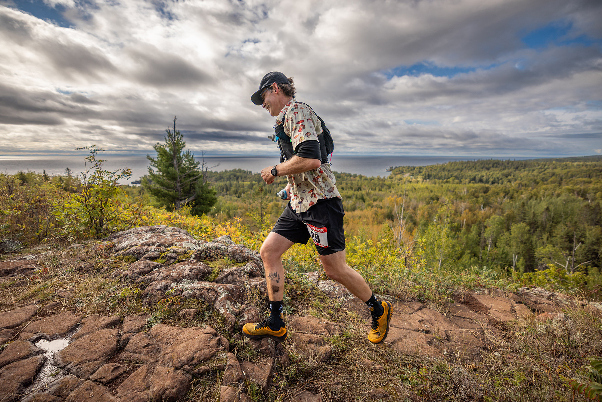
Photo Credit Howie Stern
Greetings Runners,
With just over two weeks to go, I wanted to check in and extend an early welcome to everyone. We cannot wait to see you all on the North Shore in a couple of weeks! I will, as usual, be sending out our final / week-of ‘2025 Superior Fall Trail Race Runner Welcome’ email with last minute / final updates and more, but wanted to share some things with you today.
—
General:
Superior is on Friday September 5 & Saturday September 6, 2025.
If your plans have changed and you can no longer make it to the race, there is no need to contact us. We will know you are not running if you do not show on race day.
Bib number assignments have been made and can be found on the website HERE https://www.superiorfalltrailrace.com/2025-bib-assignments/ – use this information to mark your drop bags as described on the race info page(s).
Now is a good time to study up on the Superior race website – everything you need to know about getting to the race, the distance you are running, and the race course can be found on our website.
—
Course Updates:
Trail conditions are typical of this time of year. Generally, the trails are in good shape. There were a massive number of trees to clear from the trail this spring (three to five times the normal amount). We worked diligently along with other Superior Hiking Trail Association volunteers and SHT’s contractor to open the trail for the season. After all of the tress were cleared, a significant wind storm took down more, and we were all back out clearing. Then, as the summer progressed, with some wet weather in July, more fell. At this point all ‘blocking’ trees that we know of have been cleared, but there will still be some leaners and some low trunks across the trail that will be easy to navigate.
For those that follow news on the North Shore, follow news about the Superior Hiking Trail, and those that have run the Superior Fall Trail Race previously and have a good understanding of the race course, we know you typically have a few questions about scheduled trail improvement projects and their associated closures, other reroutes / closures, and their effect(s) on the race. For those of you who are running for your first time or don’t follow Minnesota or Superior Hiking Trail news, you can probably just skim this info and concentrate on following the Superior Hiking Trail and our race markings.
IMPORTANTLY, as of Thursday August 21; charts, course maps, GPX files, and crew instructions, found HERE https://www.superiorfalltrailrace.com/maps-and-data/ have been updated to reflect all of the following changes.
Topic: The first segment of the 100 mile race from Gooseberry Falls State Park to the first aid station at Split Rock will be significantly rerouted from years past. Two different route options will remain in play until race week.
Section: Gooseberry to Split Rock
Impacts: 100 milers
The west side of the Split Rock River Loop is closed for a large scale trail rehabilitation project, as a result, the first segment of the Superior 100 Mile Trail Race will have a significant reroute. OUR FIRST CHOICE: The race will start as normal at Gooseberry Falls State Park, but instead of running the Gitchi Gami paved bike trail to Split Rock Wayside (4 flat miles on the paved bike path), then getting on the Split Rock River Loop (4.5 miles of hilly and technical trail running) to the spur into and out of the Split Rock Aid Station (at mile 8.5), our preferred route will be as follows. Start at Gooseberry Falls State Park as normal, run 1.6 miles of Gooseberry Falls State Park cross country skiing and hiking trails (wide non-technical trails with some gradual elevation gain), to 0.5 miles of snowmobile trail (wide non-technical trail, may be wet), join the Superior Hiking Trail for 5.4 miles (undulating and technical SHT), intersect the beginning of the Split Rock River Loop at Strand Creek and run 0.5 miles down to the Split Rock Wayside Parking lot (in the opposite direction of the way we normally run the loop). Run .4 miles into the back side of the Split Rock Aid Station which will be in its normal location and at its normal distance of 8.5 miles. This option has about 100ft less elevation gain than the normal route. The cutoff at Split Rock aid station will remain unchanged. While we DO NOT cross Highway 61, there will be an approximate 1/3rd mile stretch run on the shoulder of Highway 61 (running against traffic), about half of which is inside of a guardrail. Once past the guardrail you will be asked to run single-file on the gravel / grass, not on the paved shoulder. HERE is a diagram detailing the end of this segment as we approach the Split Rick aid station, HERE is a revised static course map showing the entire route, HERE is an updated live map and downloadable GPX file. OUR SECOND CHOICE: If the contractor doing the trail rehabilitation project on the Split Rock Loop starts work on the half mile of trail between Strand Creek and Split Rock Wayside in advance of the race, OR we have excessive rain in the two weeks leading into the race, we may use yet another alternate route which would consist of running a 4 mile loop within Gooseberry Falls State Park, then running the usual 4 mile segment of the Gitchi Gami Bike Path to Split Rock Wayside, and then into the backside of the Split Rock aid station at mile 8.5, running against traffic off of the shoulder as described above.
Topic: Baptism River High Falls Suspension Bridge continuing outage and associated Tettegouche reroute will impact the race again in 2025.
Section: Silver Bay to Tettegouche and Tettegouche to County Rd 6
Impacts: 100 milers
The Baptism River High Falls Suspension Bridge was closed in 2022 due to damage from historic flooding. The new bridge is now under construction but will not be open in time for this years race. The race will use the same reroute as 2022, 2023 & 2024. This is a well established reroute and runners do not need to think a lot about this, the reroute will be clearly marked. For those that would like to review it, more information can be found HERE https://www.superiorfalltrailrace.com/wp-content/uploads/2022-Superior-Fall-Trail-Race-Tettegouche-Reroute-and-Logistics-8-25-22-250PM-CST.jpg
Topic: East Branch Baptism River Bridge near Sonju Lake Road Aid Station is still out and trail still rerouted.
Section: Finland to Sonju
Impacts: 100 and 50 milers
The East Branch Baptism River bridge near the Sonju Lake Road trailhead / aid station was severely damaged by flooding on June 18 2024 and remains ‘out’ / closed. As a result the Superior Hiking Trail (and thus the race course) has been rerouted to a different bridge in order to cross the East Branch of the river. As a result of this both 100 and 50 mile runners will run ‘through’ the aid station again, rather than spur in, and back out of it as we had historically done (a happy accident that eliminates two-way traffic). The distance added by the reroute is negligible (1/20th of a mile) but does run quicker as the reroute makes use of an ATV trail and Sonju Lake Road, which is a very infrequently traveled minimum maintenance forest road. This is a well established reroute and runners do not need to think a lot about this, the reroute will be clearly marked. For those that would like to review it, more information can be found HERE https://www.superiorfalltrailrace.com/wp-content/uploads/Superior-100-Sonju-Reroute-and-Logistics-Revised-8-5-24-615PM-CST.jpg
Topic: Another tweak to the race course in the final mile of the race.
Section: Oberg to Finish
Impacts: All distances; 100, 50 & 26.2 milers.
Starting in 2024, for both our spring and fall races, in order to keep runners off of Ski Hill Road, an open / public roadway, runners have been routed off of Ski Hill Road onto Lutsen Mountain / the ski hill in the closing mile of the race. For the 2024 races runners went up the ski hill before coming back down to Caribou Highlands. For this years Superior Spring Trail Race we agreed on a new / different route with Lutsen Mountain from what we used in 2024, and it worked very well. This is the same route that we will be using for this years Superior Fall Trail Race. Once coming off of the trail and hitting the gravel portion of Ski Hill Road, runners will continue 750 feet on the gravel road (about the length of two football fields) and then need to get onto the East / left sidewalk along the paved portion of Ski Hill Road, runners will be on the sidewalk for 200 feet, then will cut up an embankment to their east / left, running behind the red gondola, will then head downhill for a short stretch crossing under Ski Hill Road on the ski run, will run behind Eagle Ridge condos / resort, over a ski hill and onto Caribou Highlands property for the finish. More information including a map / diagram can be found HERE https://www.superiorfalltrailrace.com/wp-content/uploads/Superior-Trail-Race-Revised-Finish-Route-5-12-25-700PM-CST.jpg
—

After a three year hiatus in order to do some different hat styles, we are back to t-shirts for 2025. We are very excited about these! All registered runners and volunteers will receive one of these t-shirts.
The Gray Wolf (Canis lupus), sometimes called the Timber Wolf, is the inspiration for this years Superior Fall Trail Race T-Shirt. The Gray Wolf is the only wolf species in the state of Minnesota. The majority of Minnesota’s wolf population resides in the northern regions, often in areas with dense forests. Their normal range to the south ends in a line along Center City, Milaca, Little Falls, and Detroit Lakes. In Minnesota, gray wolves primarily hunt in packs, focusing on larger prey like deer and moose, though they also consume smaller animals like beaver and hares. They employ a combination of strategies, including coordinated attacks, ambushes, and taking advantage of vulnerable animals, especially during winter when snow makes deer more susceptible. Their hunting of animals like beavers for instance, can affect forest composition. Gray wolves in Minnesota typically weigh between 70 and 110 pounds for males and 50 to 85 pounds for females, with an average length of 4.5 to 6.5 feet. Individual wolves can vary in size due to factors like age, sex, and genetics. While encounters between humans and gray wolves in Minnesota do occur, they are relatively uncommon, especially direct, close encounters. The Minnesota Department of Natural Resources (DNR) states that wolves generally avoid human interactions. People often mistake coyotes for wolves. Gray wolves and coyotes can be distinguished by size, facial features, and tail carriage. Wolves are significantly larger, with broader snouts and shorter, more rounded ears compared to coyotes, which have pointed ears and a more fox-like appearance. Wolves also tend to have a more direct, purposeful travel path, while coyotes may meander more. HERE is a great article further delving into gray wolf and coyote identification https://www.voyageurs.org/news/wolves-and-coyotes While it is unlikely that you will see a gray wolf during a race, if you spend enough time on the Superior Hiking Trail, or in the Superior National Forest, you will eventually get lucky enough to see one!
—
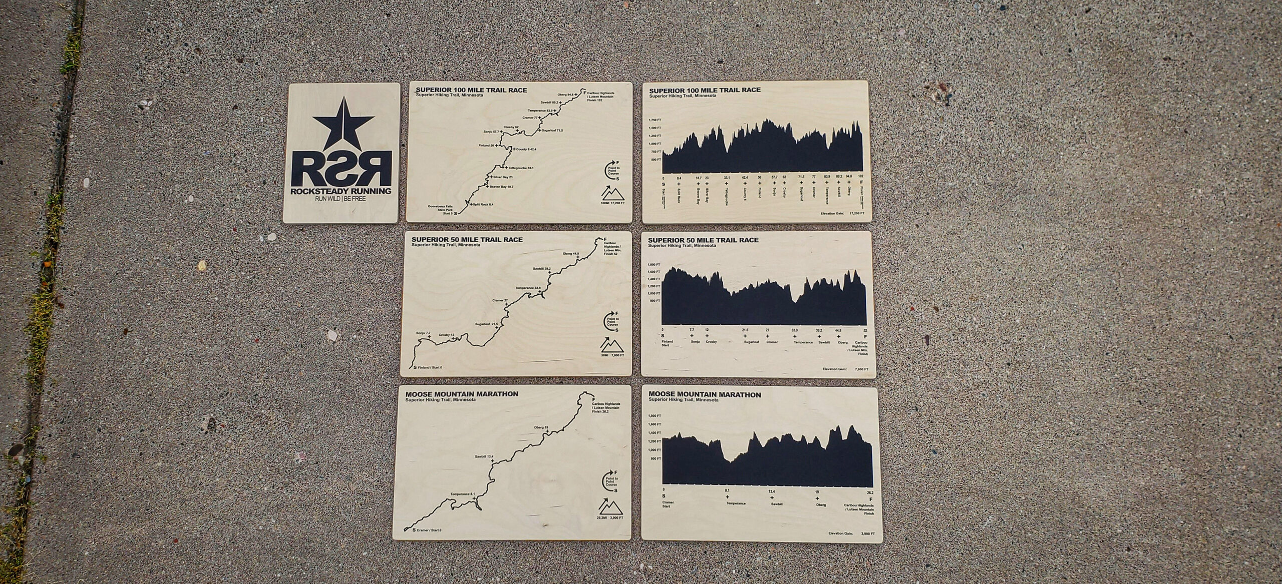
Superior Fall Trail Race Wood Print Map and Elevation Charts:
We are happy to offer these super cool Superior Fall Trail Race course map and elevation chart art prints for sale again in 2025. We produce these prints with a close friend of ours, in his local shop. Each print starts its life as a full sheet of plywood that we are going and picking up, transporting, ripping to size, routing, sanding, printing, packing and transporting to the race(s). We only have the ability to produce a limited number of these. They will be available at the race check in(s) (and possibly the race finish) until they are gone. First come first served.
—
VERY IMPORTANT – CAMPING OR SLEEPING IN YOUR VEHICLE IN THE LUTSEN PARKING LOT IS NOT ALLOWED:
Lutsen Mountain graciously allows racers to park in their large surface gravel parking lot, across Ski Hill Road from Caribou Highlands Lodge for both the Spring and Fall races. They have asked us to pass a note to race participants that camping or sleeping in your car, van, truck, etc. is not permitted in their parking lot or anywhere on their property. Failure to comply with this could negatively impact the race. If you need somewhere to camp the night before or after the race we suggest one of the following options; Burlington Bay Campground in Two Harbors, Gooseberry Falls State Park northeast of Two Harbors, Split Rock Lighthose State Park southwest of Beaver Bay, Black Beach Campground in Silver Bay, Tettegouche State Park northeast of Silver Bay, Finland Campground near Finland, Eckbeck Campground near Finland, Wildhurst Lodge and Campground near Finland, Lambs Resort in Schroeder, Temperance River State Park near Tofte, Cascade River State Park northeast of Lutsen, Grand Marais Municipal Campground in Grand Marais.
—
As always, a huge thank you to sponsors and partners. Please take a moment to click the link and check them out https://www.superiorfalltrailrace.com/sponsors/
If you are not quite ready to get back to what you were doing, linger a few more minutes and get stoked for what’s to come! https://www.superiorfalltrailrace.com/photos-2024-highlights/
That is all I have for you today, thank you for your time! Look for one final communication from me about a week out from the race. We can’t wait to see you all at Superior!
In Community,
John Storkamp
Race Director
Superior Spring Trail Race