We strongly encourage everyone running the Superior Trail Race to review this page in its entirety
The Superior 100, 50 and 26.2 mile trail races are held on the Superior Hiking Trail. The Superior Hiking Trail is a well established and well-marked hiking trail that is easily navigated if you pay attention, look for, interpret, and read the provided signage. Each year 10’s of thousands of trail-users use these permanently installed trail markings to successfully navigate the trail; on day hikes, trail runs, backpacking trips and thru-hikes – both during the day and night, every month of the year – running a 100, 50 or 26.2 mile race should not be much different. We ask that you take responsibility for your own race, have a fundamental understanding of where you are going, how the trail is marked and what to look for – the information on this page will help further your understanding.
GENERAL ORIENTATION:
You will generally be running northeast on the Superior Hiking Trail, following Superior Hiking Trail / North Country Trail signage and blue blazes in addition to supplemental flagging provided by the race which is primarily put in place for night time navigation of the trail. An excellent landmark is Lake Superior, it will be on your right-hand-side the vast majority of the race.
PRIMARY COURSE MARKINGS:
The Superior Hiking Trail is permanently marked with painted, vertical / rectangular “blue blazes” along with some plastic, rectangular “Superior Hiking Trail” signs. Blazes and signage are painted or affixed onto trees at varying intervals depending on several factors such as; number of intersecting trails, popularity of the trail section, whether or not the section is within a state park or on private land etc. Generally, you will see a blaze or a sign every 1/8 to 1/4 mile.
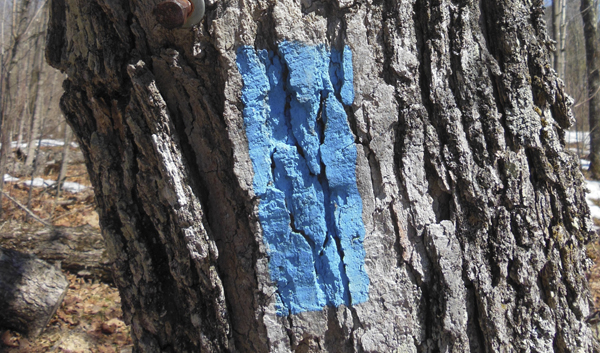
* Pictured above: Painted “Blue Blaze”, typically 2″ wide X 6″ tall, painted on Trees at eye level and spaced 1/8 to 1/4 mile apart – FOLLOW THESE
*Pictured above: plastic Superior Hiking Trail sign, typically 5″ Wide X 3″ tall, nailed to trees at eye level – FOLLOW THESE
SPUR TRAILS – DO NOT FOLLOW THESE, EXCEPT…
Spur trails are trails that are not the main Superior Hiking Trail. Spur trails usually lead to parking lots, overlooks and other points of interest. Spur trails are marked with white paint blazes instead of the blue blazes described above. In addition to white blazes you may also see plastic Superior Hiking Trail “SPUR TRAIL” signs (pictured below).
IT IS VERY IMPORTANT TO NOTE that the only time that you ever follow a spur trail, white blazes or plastic “spur trail” signs or depart from the main Superior Hiking Trail are as follows: (note that these deviations from the main trail will be marked with supplemental signage put in place by the race.)
• 100 mile race start. The first 4.5 miles of the Superior 100 is on the paved Gitchi Gami Bike Trail
• Spur Trail to the Split Rock Aid Station (100 Mile Race)
• The 100 mile race start will be different in 2025 than it has been for the last number of years. 100 mile runners will start on a series of Gooseberry Falls State Park hiking, ski and snowmobile trails prior to getting onto the Superior Hiking Trail. More information can be found HERE https://www.superiorfalltrailrace.com/superior-fall-trail-race-2025-just-over-two-weeks-to-go/
• Trails associated with the Tettegouche reroute (100 Mile Race) https://www.superiorfalltrailrace.com/superior-100-tettegouche-reroute-and-logistics/
• Spur Trail to the Finland Aid Station (100 Mile Race)
• Reroute coming into Sonju Lake Road Aid Station (100 & 50 Mile Races) https://www.superiorfalltrailrace.com/wp-content/uploads/Superior-100-Sonju-Reroute-and-Logistics-Revised-8-5-24-615PM-CST.jpg
• The final 1.25 miles of the races (100, 50 and 26.2 mile races) after crossing the Poplar River https://www.superiorfalltrailrace.com/wp-content/uploads/Superior-Trail-Race-Revised-Finish-Route-5-12-25-700PM-CST.jpg
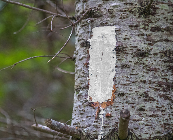
Pictured Above: White paint blazes are used to designate ‘spur trails’.
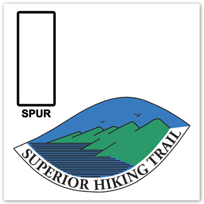
Pictured Above: SPUR Trail Sign
SUPPLEMENTAL MARKINGS:
In addition to the Superior Hiking Trail Signage described and pictured above, the race will place supplemental markers on the trail. The markers from the 100 mile race start at Gooseberry Falls State Park to Silver Bay will be non-reflective survey style makers and have the Rocksteady Running Logo on them. The markers from Silver Bay to the finish will be reflective, helping runners with night-time navigation. These reflective flags will have heavy-gauge wire stakes that will be stuck in the ground, with fluorescent and reflective ribbon tied through a lop on the top. These flags will always be placed on the left hand side of the trail except in instances of two-way traffic (spur trail into the Split Rock and Finland aid stations – 100 mile race only), in this case they will be placed on both sides of the trail – upon exiting two-way traffic, the markers will again be on the left hand side of the trial only. Generally these markers will be placed at and beyond critical intersections and will be between 1/8 and 1/4 mile apart.
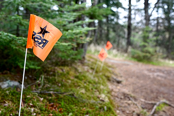
Pictured Above: Daytime / non-reflective flags, used from the 100 Mile race start at Gooseberry Falls State Park, to Silver Bay
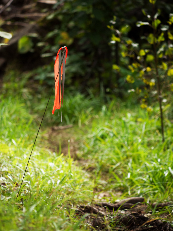
Pictured Above: Fluorescent orange / reflective Superior 100, 50 & 26.2 reflective course marker placed on the left hand side of the trail from Silver Bay to the race finish at Caribou Highlands.
COURSE VANDALISM:
It is very unfortunate and not unheard of at many of the major trail races around the country that course vandalism has occurred and flagging has been intentionally moved or removed – this is why it is important that you study the course prior to running and have a concept of where you are going (we can only control what we can control) , always remember (as illustrated above), that you are supposed to be on the Superior Hiking Trail (except in those specific instances listed) and tens of thousands of people navigate this trail from point to point each year without additional markings and without incident.
Navigating by watch or phone using race provided GPS / GPX files – an additional point of reference:
Below you will find a link to download GPS / GPX files for the Superior Fall Trail Race via ‘plotaroute’. It is important to note that due to human and technological error, either on your end or ours, last minute course changes, etc. GPX tracks provided may not upload / render or be 100% accurate. It is important to to take into consideration several sources of information when navigating including the course markings that we put out, Superior Hiking Trail / North Country Trail ‘blue blazes’, and static race course maps, in addition to GPS. https://www.superiorfalltrailrace.com/gps-gpx-files/
ADDITIONAL RESOURCES:
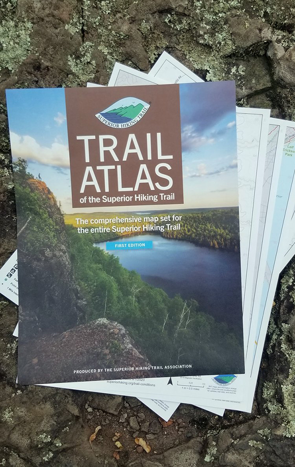
The Superior Trail Race has our our own set of maps unique to the race, the general purpose of these maps are to provide a basic understanding of the layout of the race course and distances between aid stations – these maps can be found HERE https://www.superiorfalltrailrace.com/maps-and-data/. Additionally, the Superior Hiking Trail Association produces a great set of paper-maps with additional detail that are of great use when hiking and running the trail, they can be purchased directly from the Superior Hiking Trail Association HERE https://shop.superiorhiking.org/products/trail-atlas-of-the-superior-hiking-trail